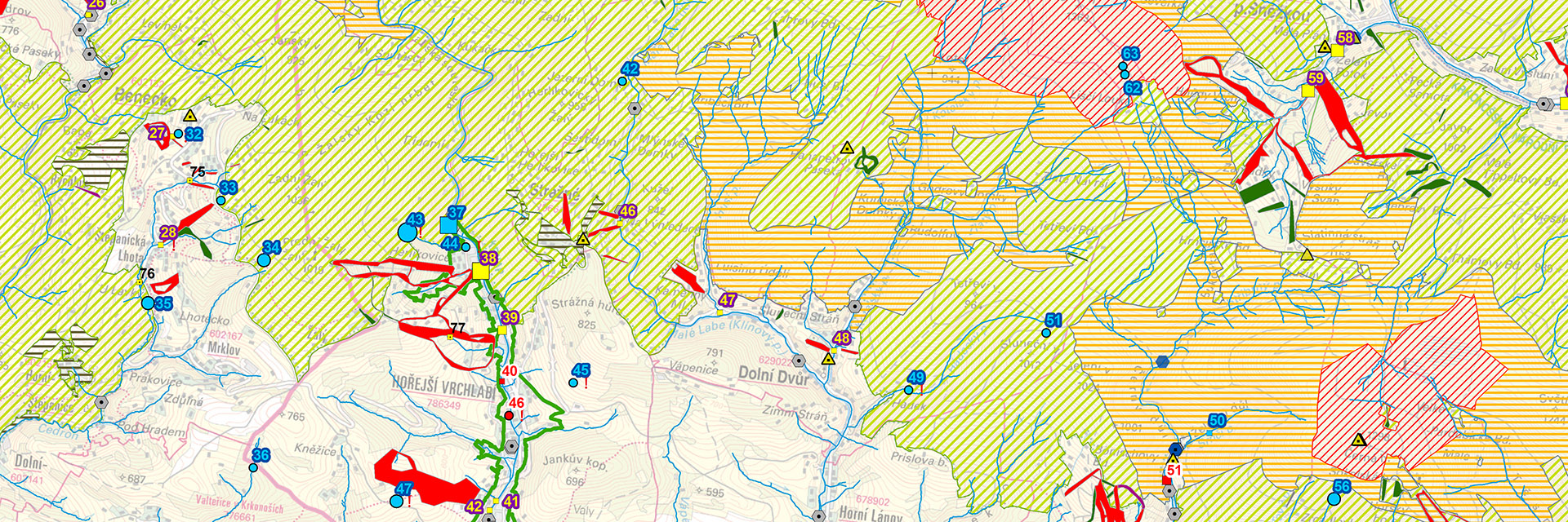
Map of the impact on the Krkonoše National Park area by artificial snowmaking and other water abstractions
The map of the impact on Krkonoše National Park by artificial snowmaking and other water abstractions shows water abstractions from watercourses and groundwater sources (greater than 500 m3/month) in the Krkonoše Mountains. Based on data from the table below and the size of the symbols used, it is possible to compare the size of water abstractions between individual customers in the period 2015-2019 and thus compare the amount of water abstraction for artificial snowmaking on ski slopes with the size of other abstractions. The map also shows the position of the ski slopes with an indication of a part of the ski slope where artificial snow is used and where it is not. There is also a summary of water measuring and meteorological stations. An essential part of the map is the location of individual nature protection zones within Krkonoše National Park.
You can download the map in the original resolution here, the data table for the map here (in Czech).

