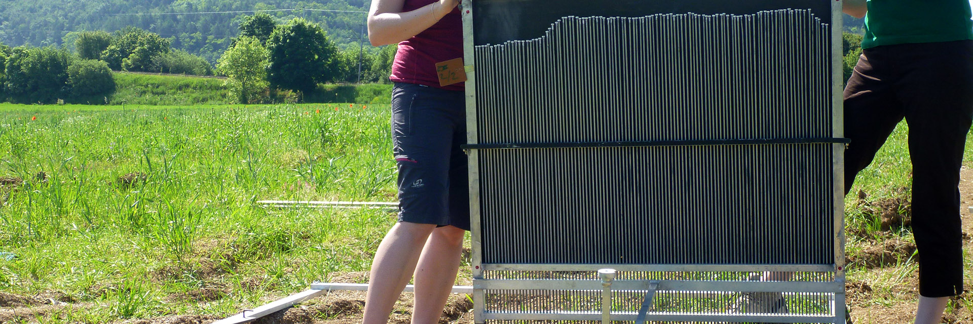
Erodometer (field erosion measuring device)
The device enables the measurement of the transverse profile of the terrain, which serves for the volumetric quantification of rill erosion on the land area.
It is a method of direct measurement of the terrain. This type of measuring device was developed at the Department of Landscape Water Management, Faculty of Civil Engineering, Brno University of Technology. When quantifying rill erosion, the terrain is recorded in a square frame measuring 2×2 m, in which five profiles are plotted in the entire width of the field at regular distances (about 0.33 m). The square frame with erodometer is placed on the erosion-affected slope. The soil surface is marked by needles for the entire width of the erodometer (1 m), the upper parts of which, when lowered into the ground, copy the course of the soil surface. It is documented using a camera and converted to a digital form as a graph, which is then used to determine the volume of erosion rills.