The solution is focused on the application of flood risk analysis procedures, which is primarily a semi-quantitative and quantitative assessment of the degree of threat to an area and the extent of flood consequences. Hydraulic modelling tools are being developed and used as widely as possible in order to specify the extent of the impacts of these extreme phenomena on infrastructure (with special regard to critical infrastructure).
To meet the first of the Floods Directive main requirements, the Methodology of Preliminary Flood Risk Assessment (in Czech) was prepared as a fundamental input action for a new, qualitatively higher method of processing the entire issue of flood protection. Based on this methodology, areas with a significant flood risk were defined in cooperation with the state river basin authorities. In 2011, these represented sections of significant watercourses with a total length of 2,965 km; after updating in 2017, it was a total length of 2,846 km.
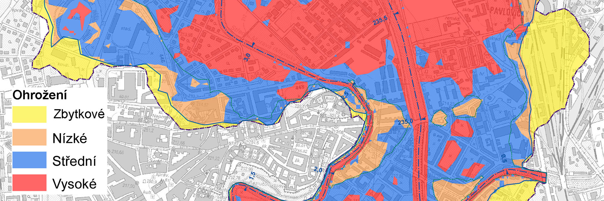
Another obligation arising from the Floods Directive is the creation of flood hazard and flood risk maps in areas with a significant flood risk. The procedures for this were defined in the Methodology for the Creation of Flood Hazard and Flood Risk Maps, which were compiled during several S&R projects financed by the Ministry of the Environment. Based on this methodology, flood hazard and risk maps were created in 2013 and 2019 in areas with a significant flood risk. Flood hazard maps have become part of the documentation when setting up the method and scope of processing and determining floodplains and their documentation according to Decree 79/2018 Coll.
The final requirement of the Floods Directive is to draw up flood risk management plans. Within the implemented projects, procedures were proposed for determining the effectiveness of individual measures, procedures for evaluating systems of measures, etc. The evaluation of significant flood events is part of the land restoration process. TGM WRI has a long tradition of working on projects aimed at assessing the progression and impacts of major floods. It is an evaluation of the activities of the flood service and units of the Integrated Rescue System (emergency services), assessment of the impact of hydraulic constructions on the progression of floods, as well as evaluation of the flood impacts on society and the environment. You can find flood assessment projects in which TGM WRI has participated here (in Czech).